On and Below the Burren

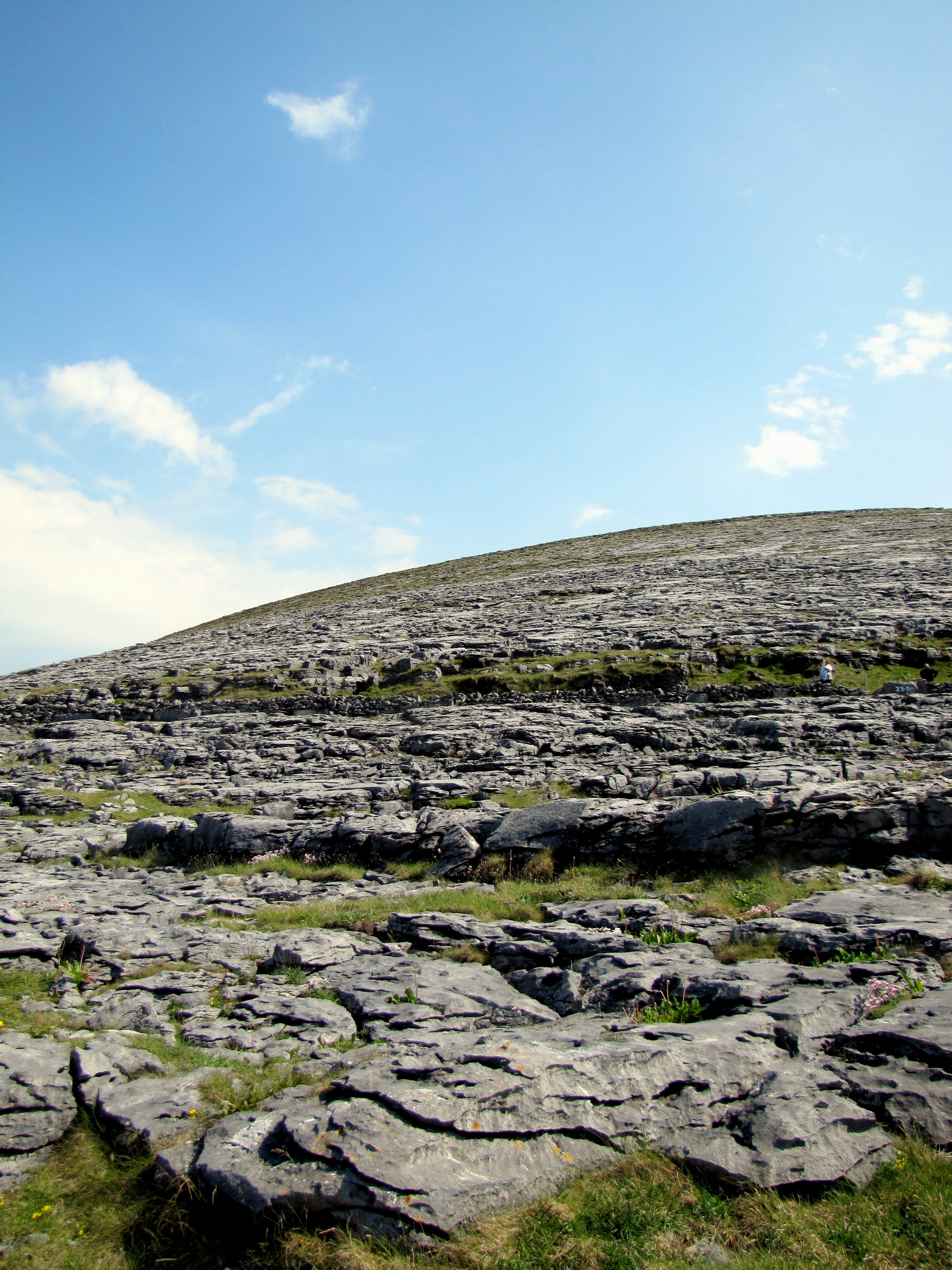
Today was the last of my bus tours out of Galway, down to the Burren and the Cliffs of Moher. It was another really nice day, weather-wise, though there was a little bit of rain at our last photo stop. I’d been to the Cliffs before, and to the Burren, but the weather was much better this time.

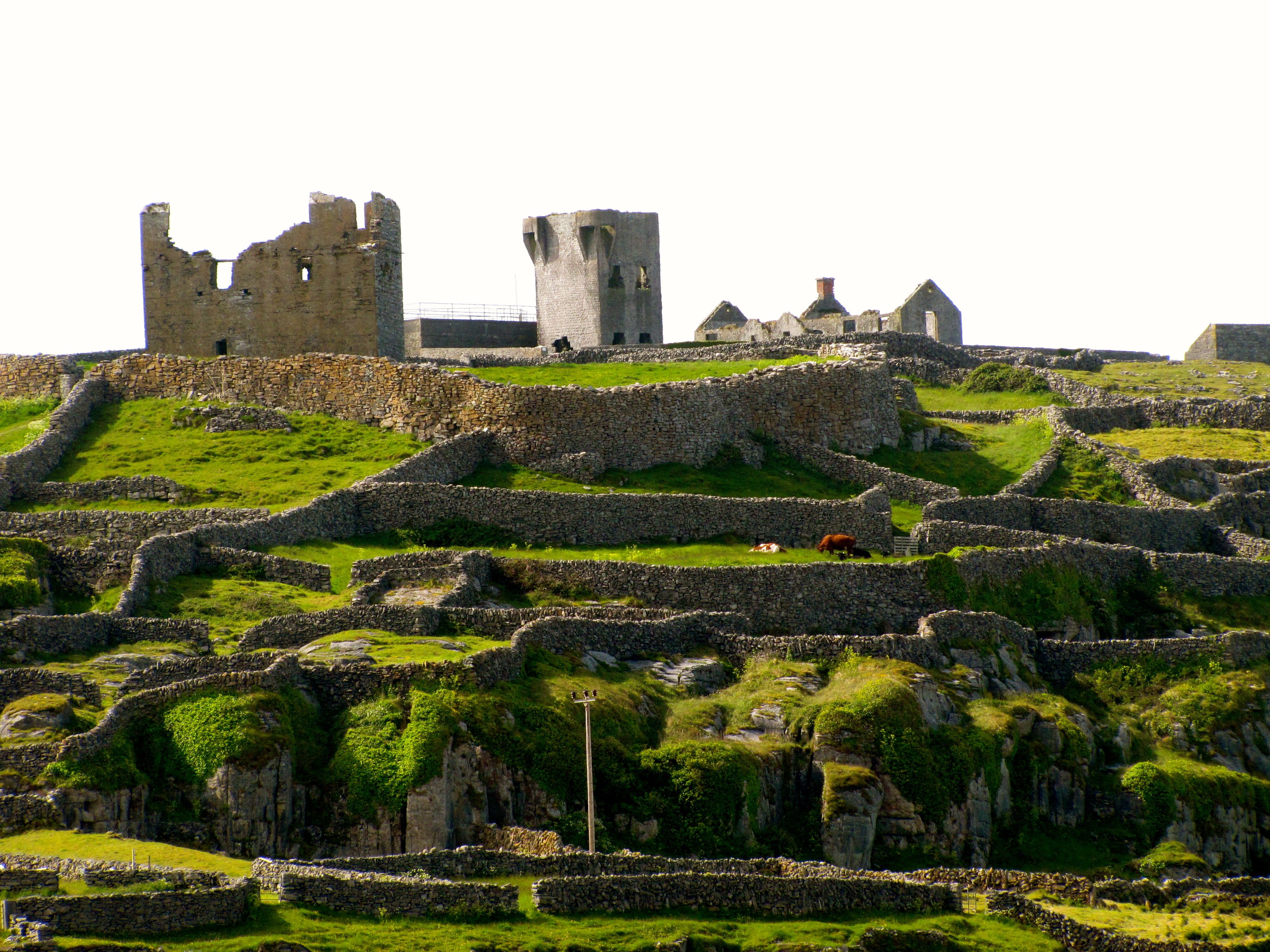
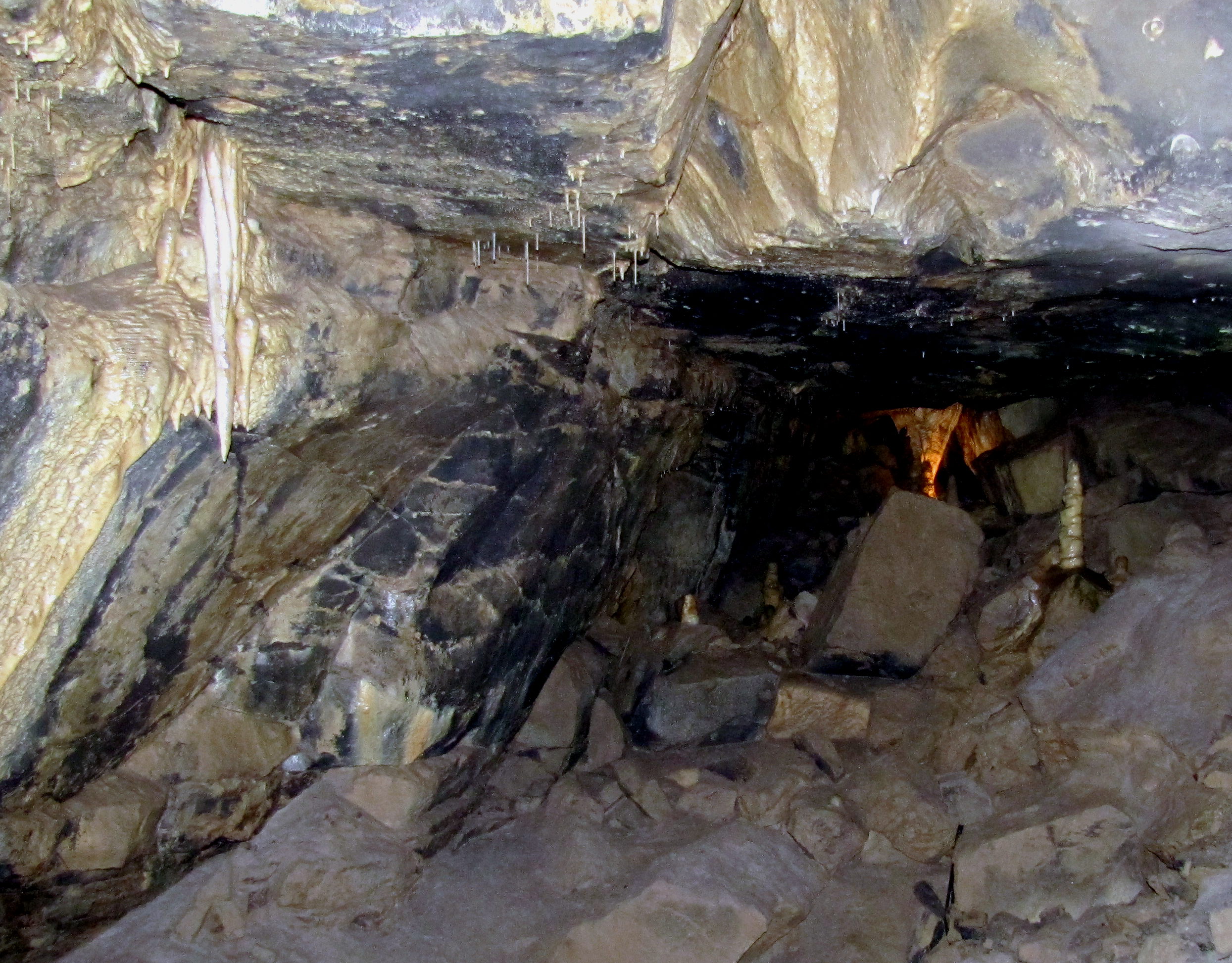
The last tour I’d been on was from a different company1, so the stops were a little different. I was a little said that we didn’t get to the Poulnabrone Dolmen, this time, but instead we did get to see the Aillwee Cave.

The Aillwee Cave is on the side of Aillwee Mountain, and it’s got a pretty good view of the Burren. How gorgeous is that sky?
Inside the cave, it was very dark. Yeah, I know, that’s the way it goes with caves, but this one was less lavishly lit than any other cave I’ve been in. While it was very cool, I got nervous about my footing at some points. Anyway, here’s a shot of some stalactites, stalagmites, and a full column way at the back that looks orange in this picture.

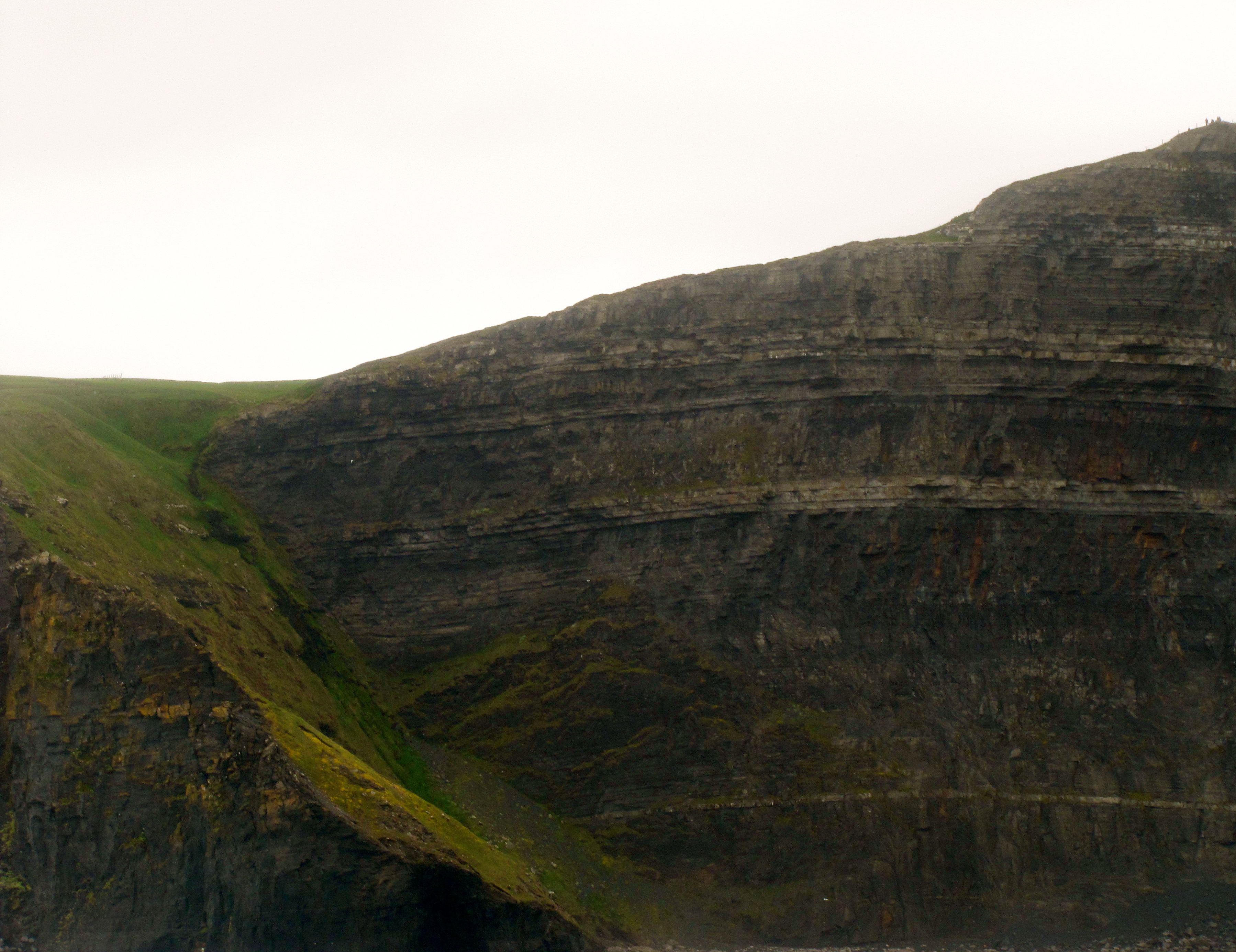
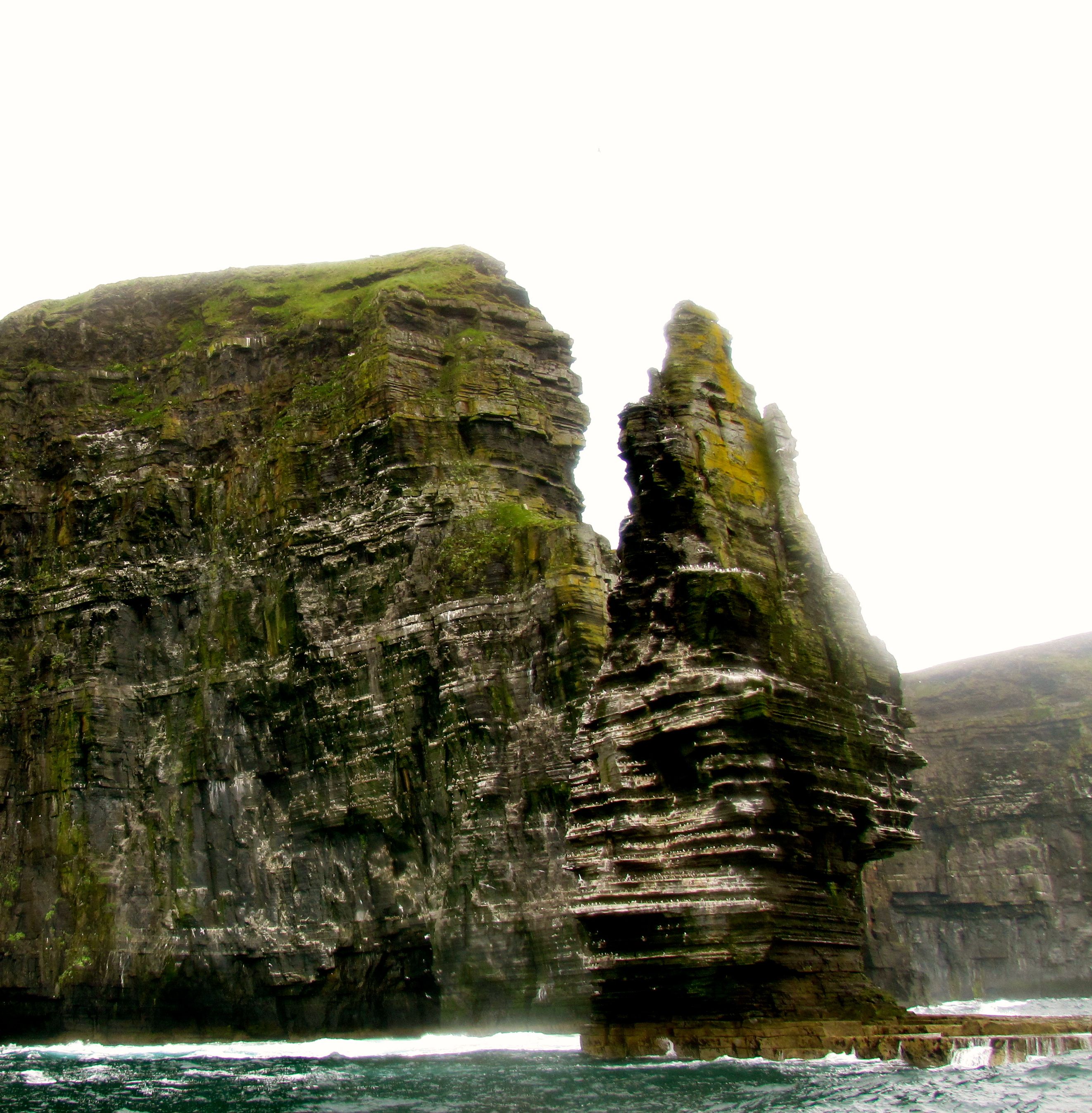
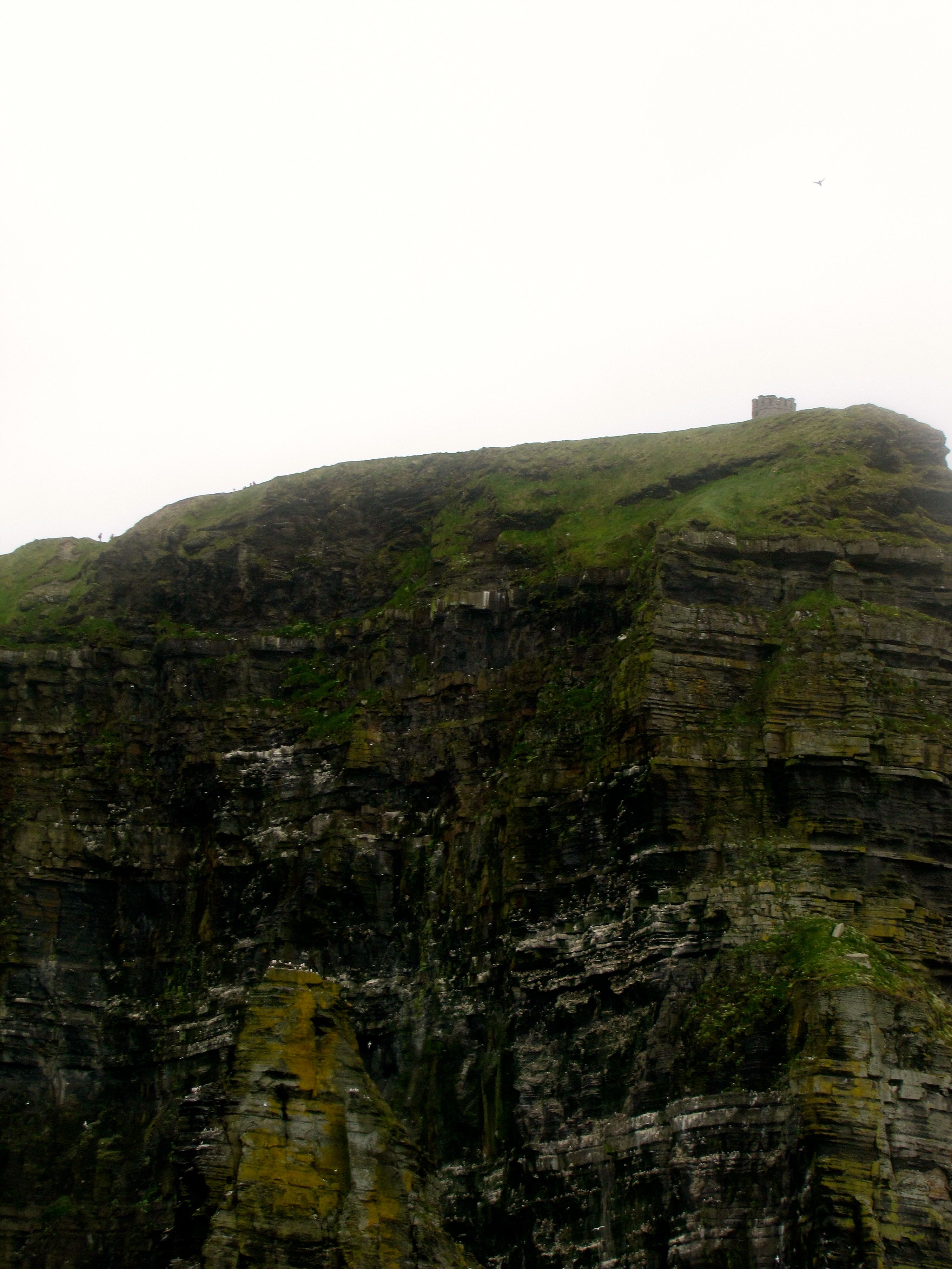
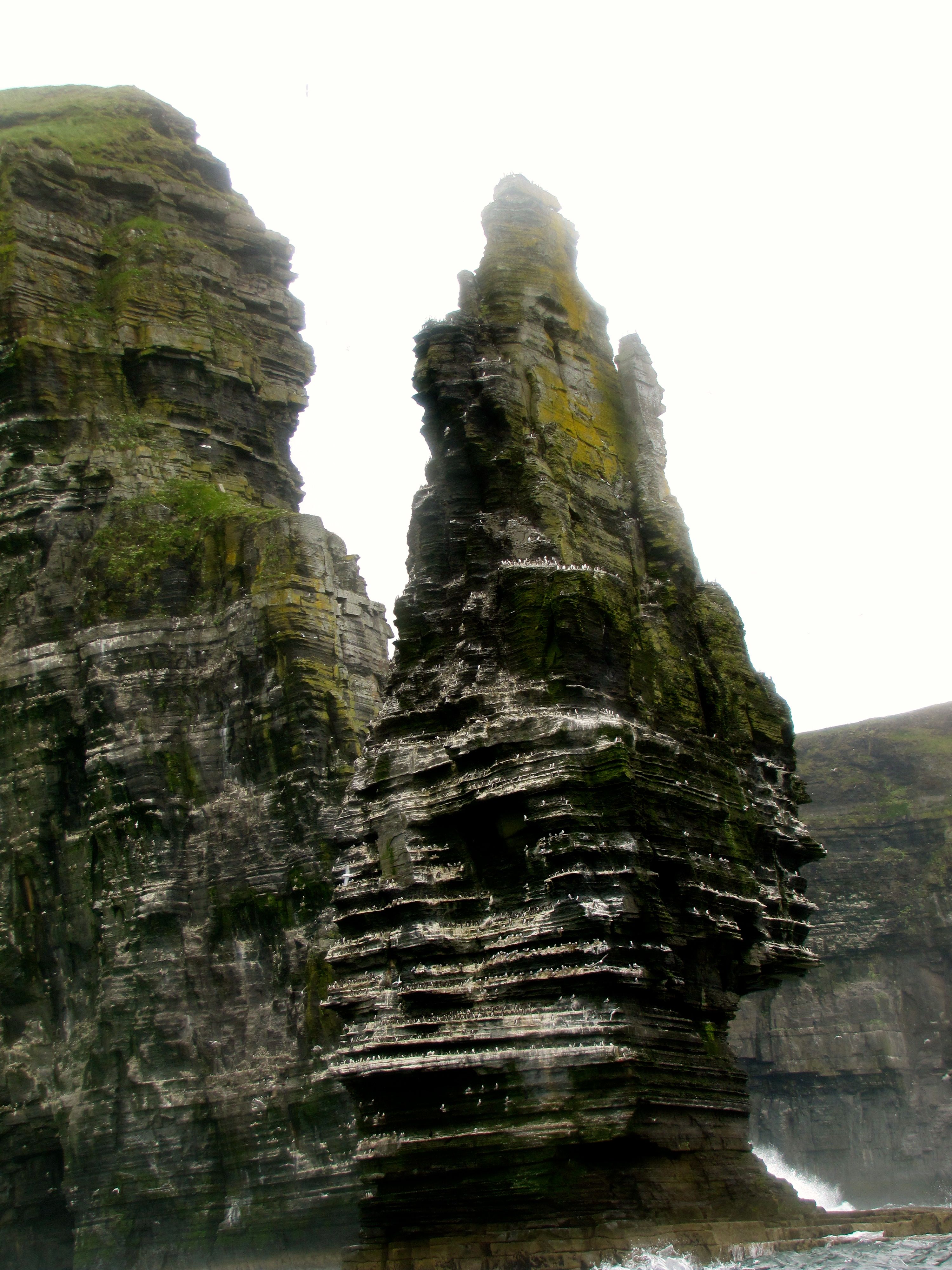
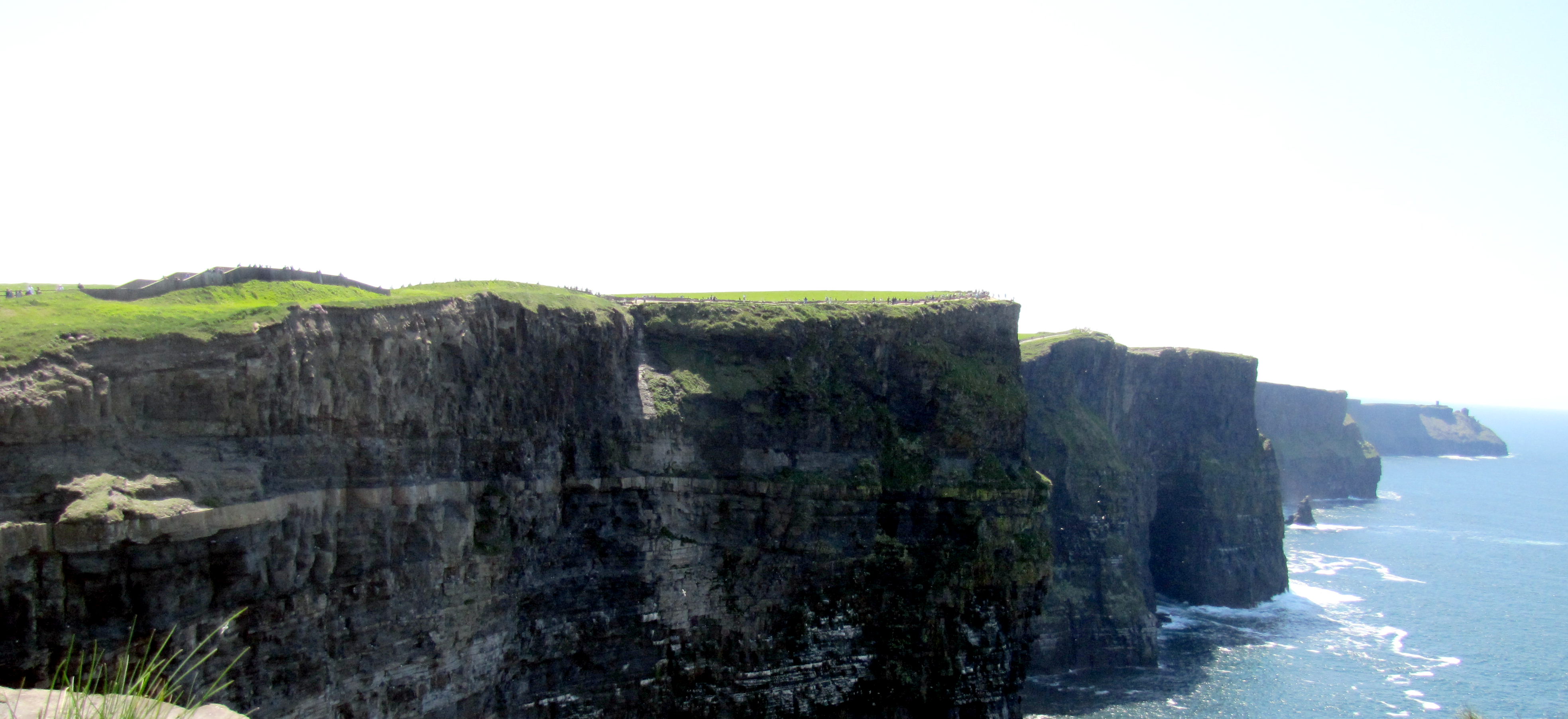
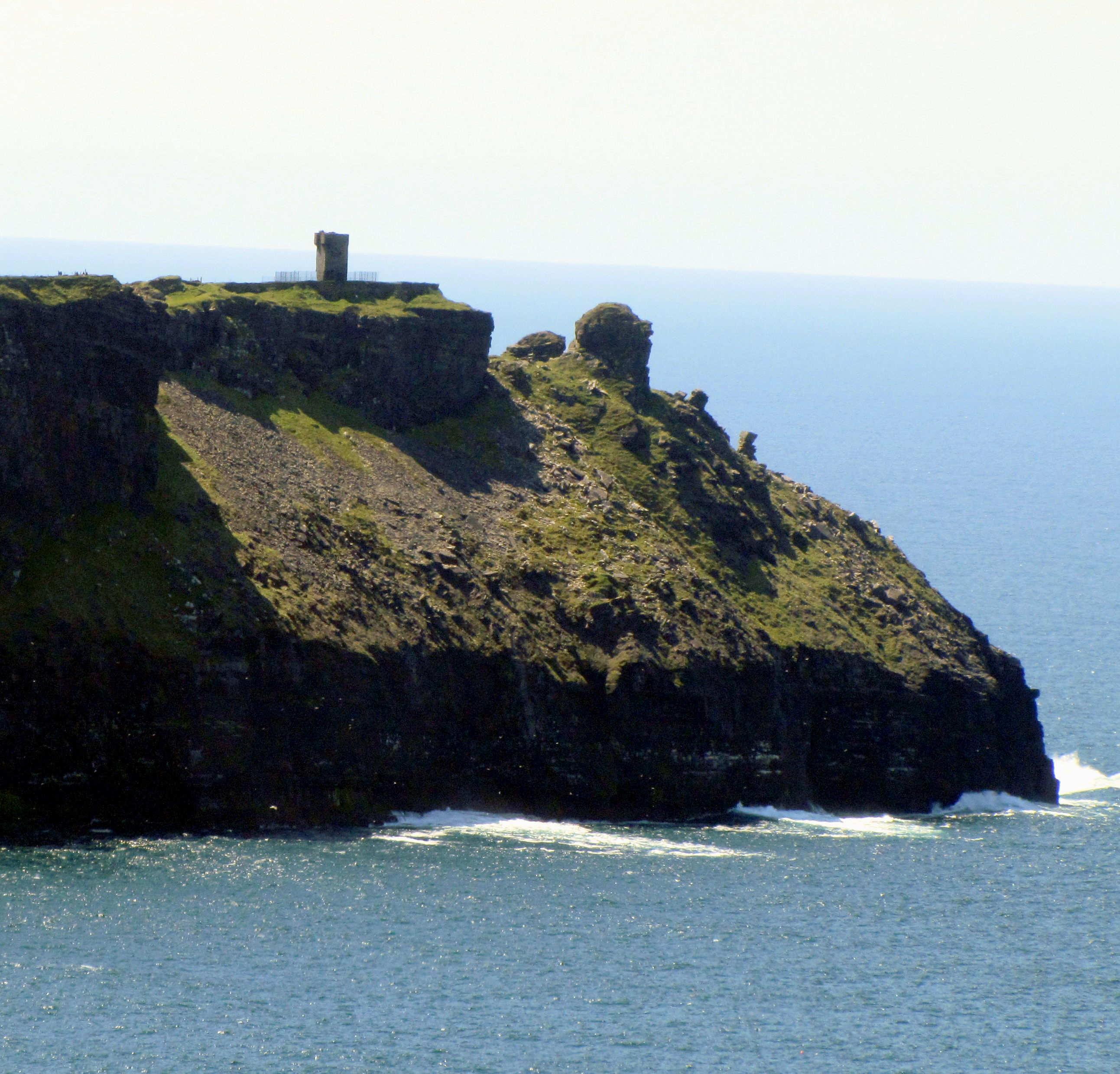
After Aillwee Cave, we went to the Cliffs of Moher, which was the main stop of the day.

The Cliffs of Moher are about 200m above the sea. They were used as the Cliffs of Insanity in the movie The Princess Bride.
Waaaaaayyy down at the end of the Cliffs is Hag’s Head, an outcropping that has a small tower (called Moher Tower). It was too far to walk in the time we had there.

I also completed one of my vacation objectives here: I found a nice ring at a little jewellery shop dug into the side of the hills.

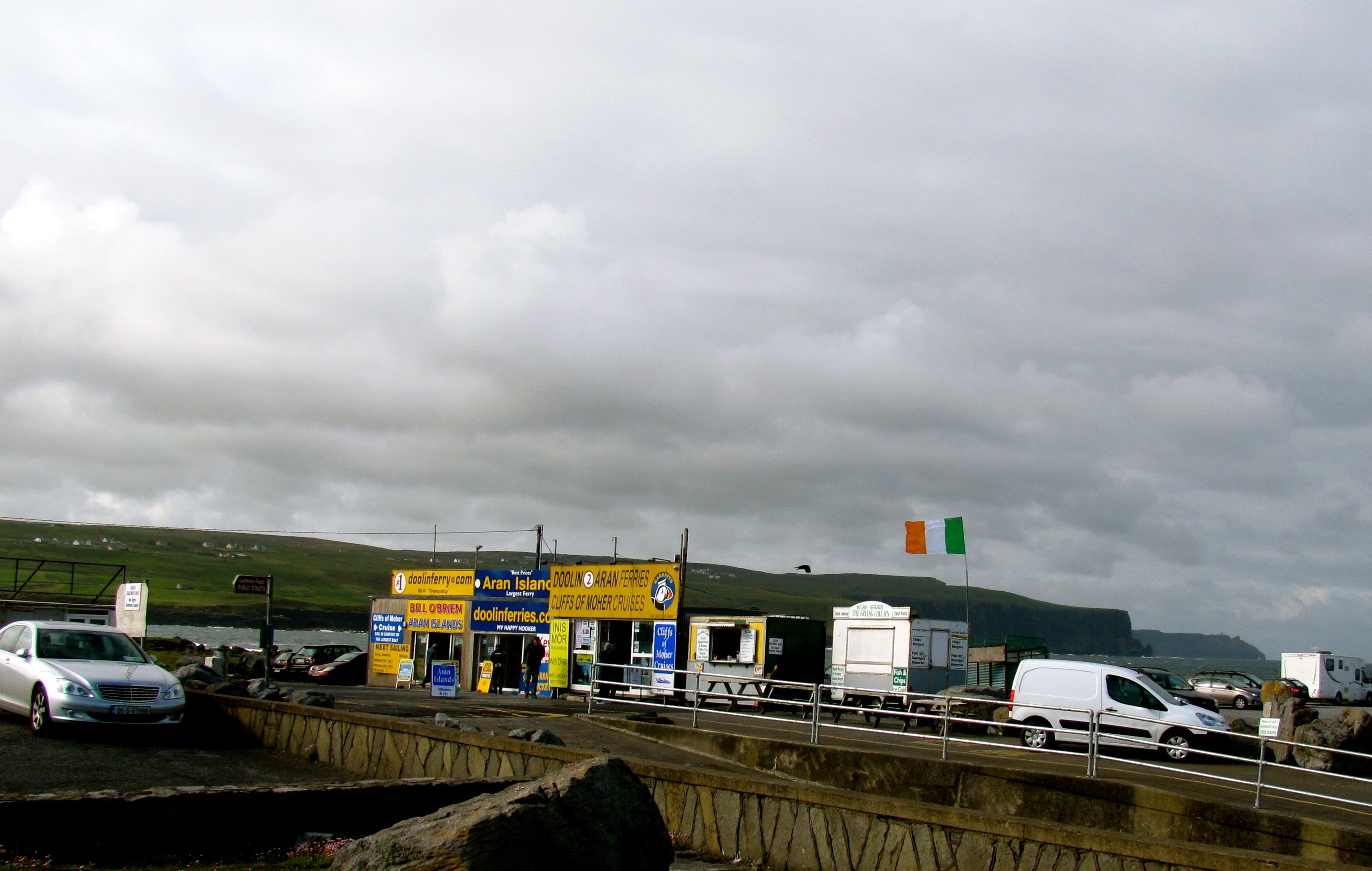
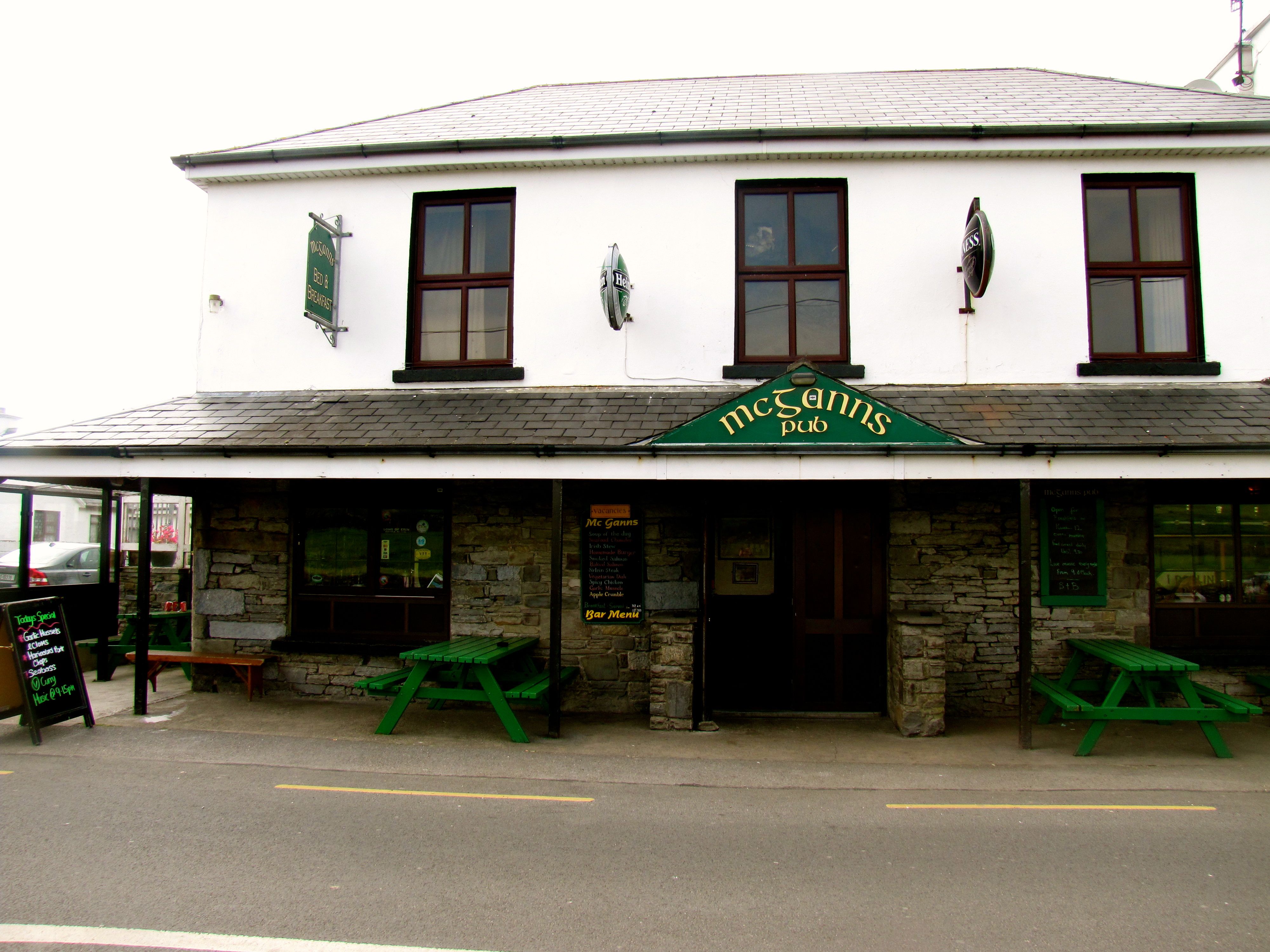
Lunch was in Doolin, and it was nice to go back there, where I had had such a good stay last time. We came in from an unfamiliar direction, so it took me a little thinking to orient myself, but it was cool to realize I recognized where I was, and where McGann’s was from there.

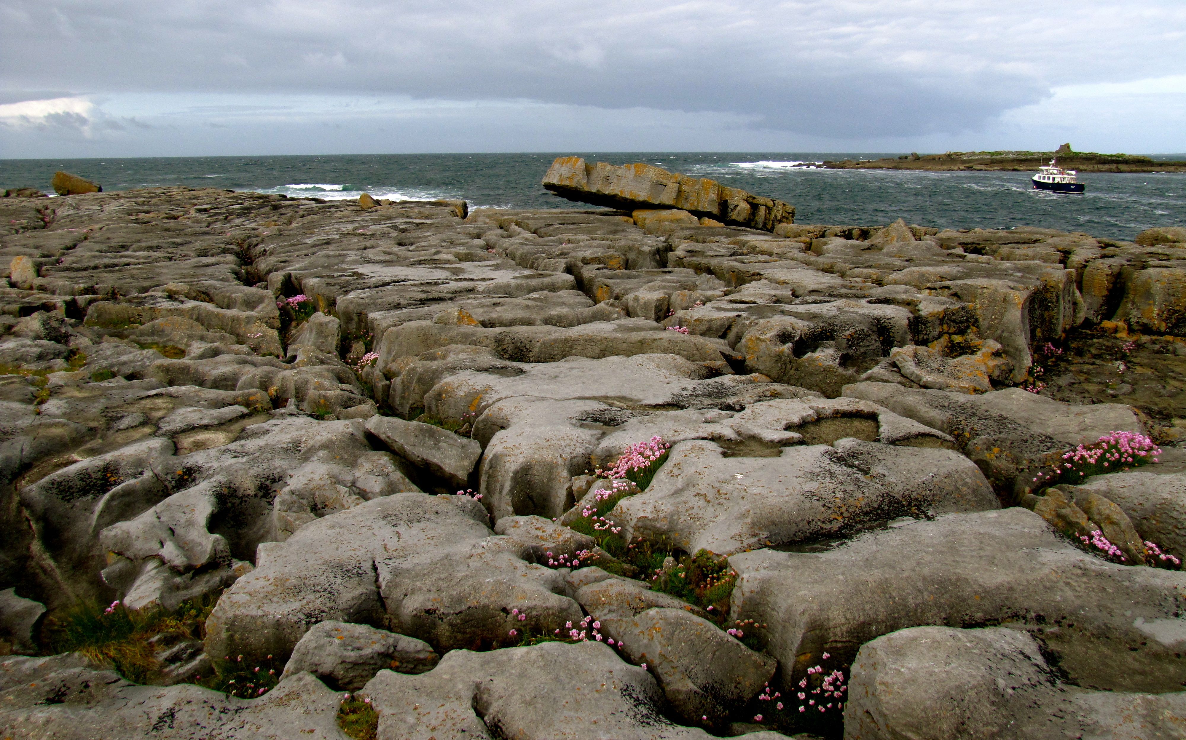
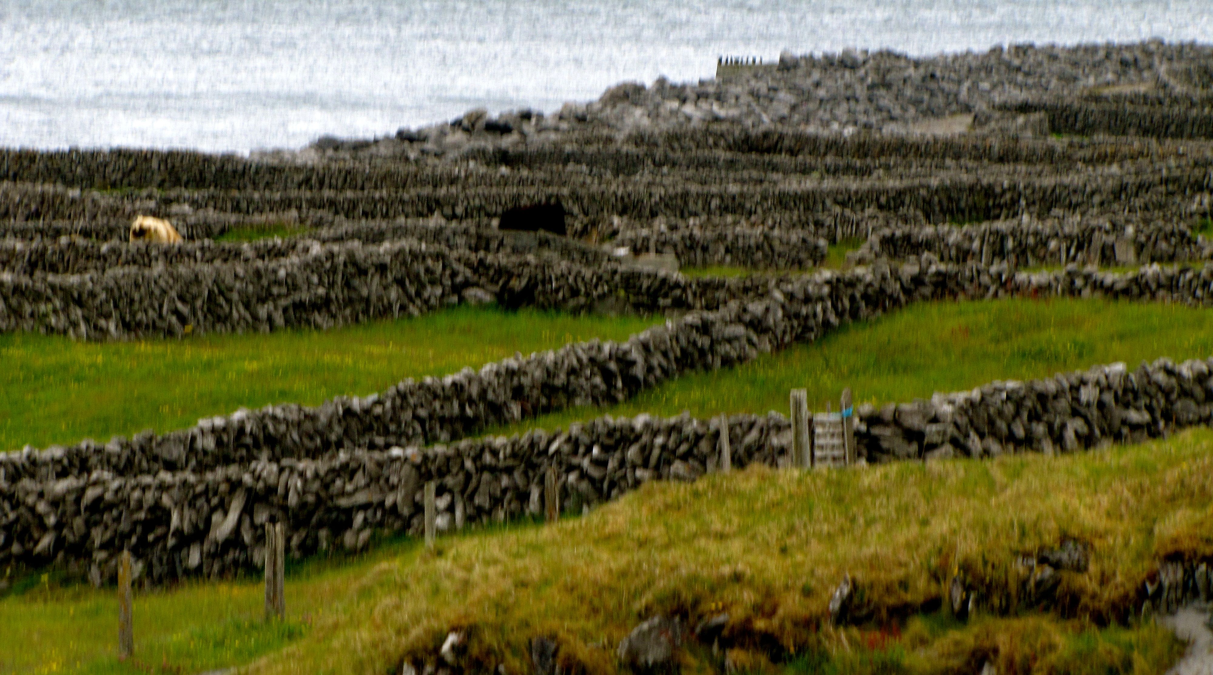
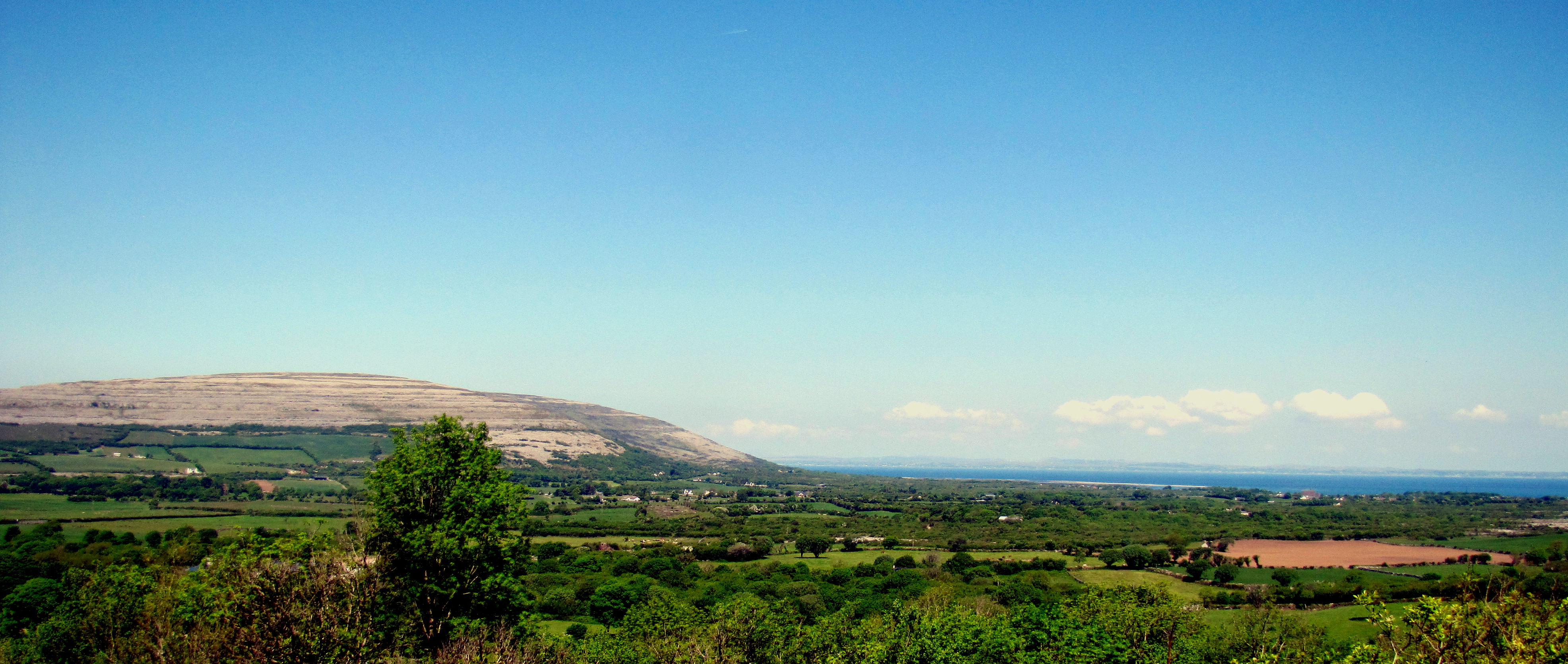
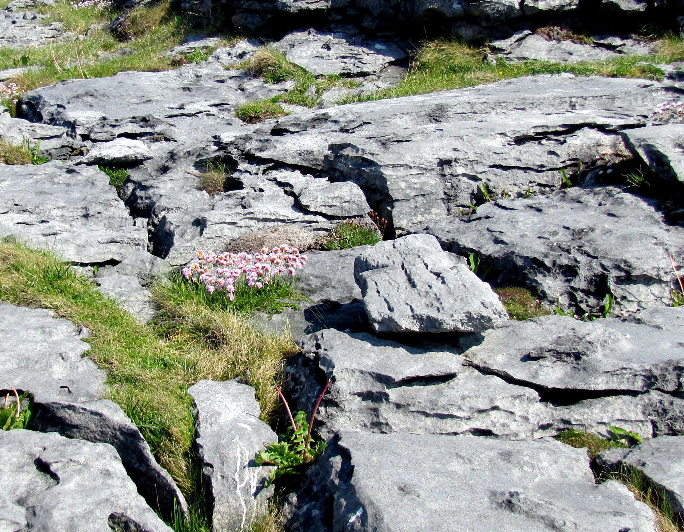
We stopped along the coast road on the way back to Galway at the Blackhead Lighthouse, which was right in the midst of a lot of the interesting rock formations of the Burren.

This is the sort of landscape that makes the Burren the Burren. Weathered limestone with lots of plants growing in the gaps between the slabs.
It being spring, there are a fair number of wildflowers cropping up.

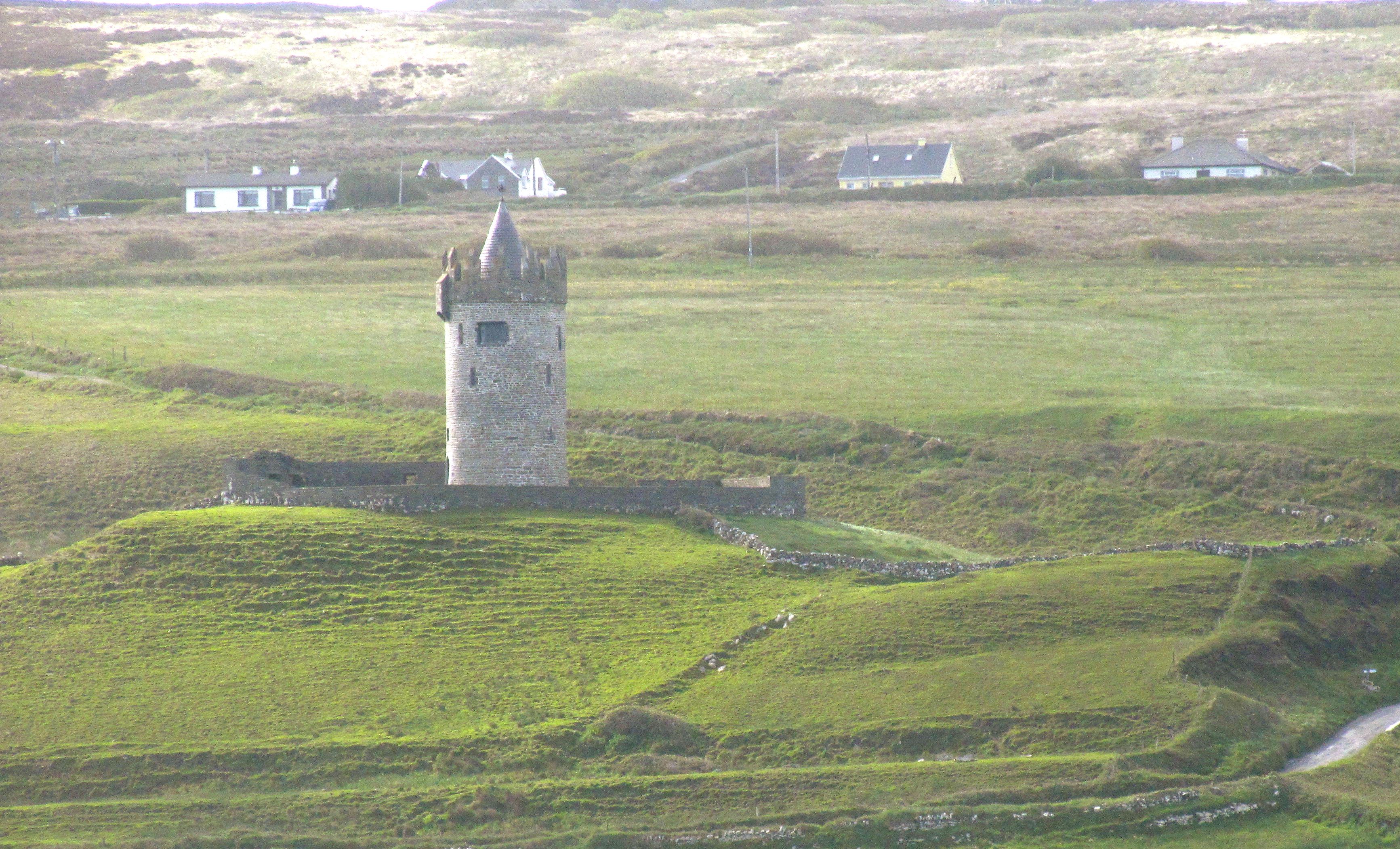
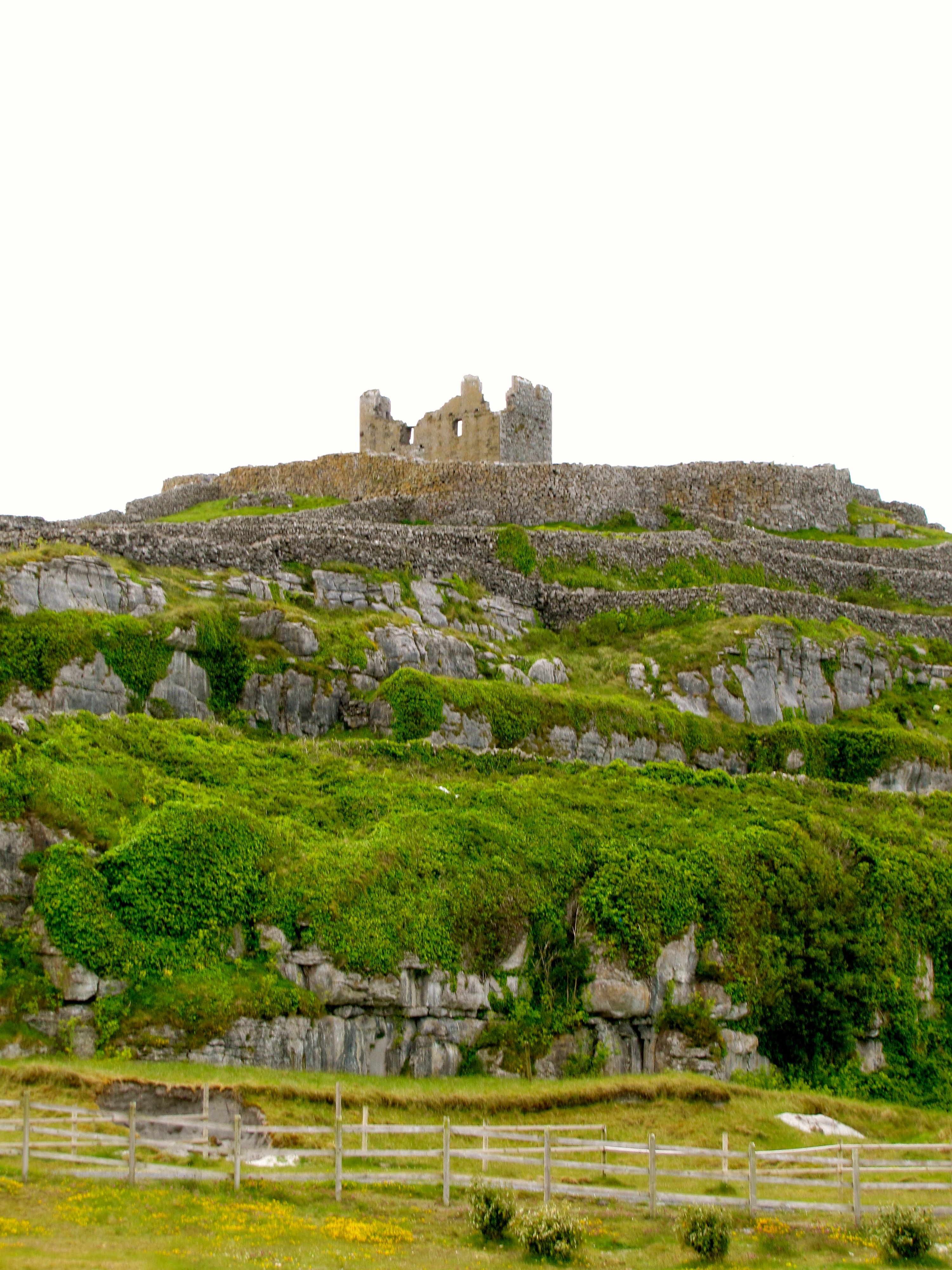
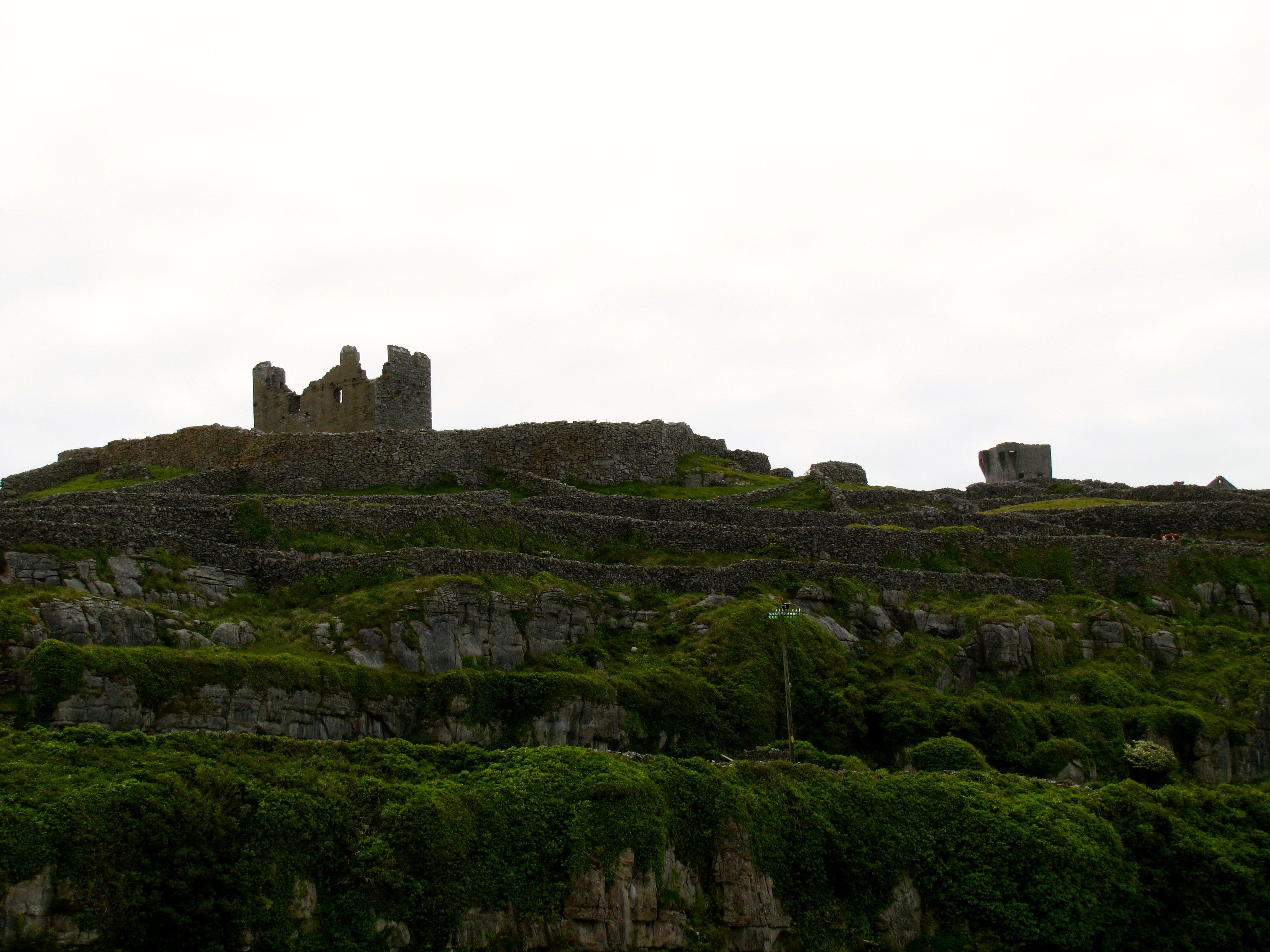
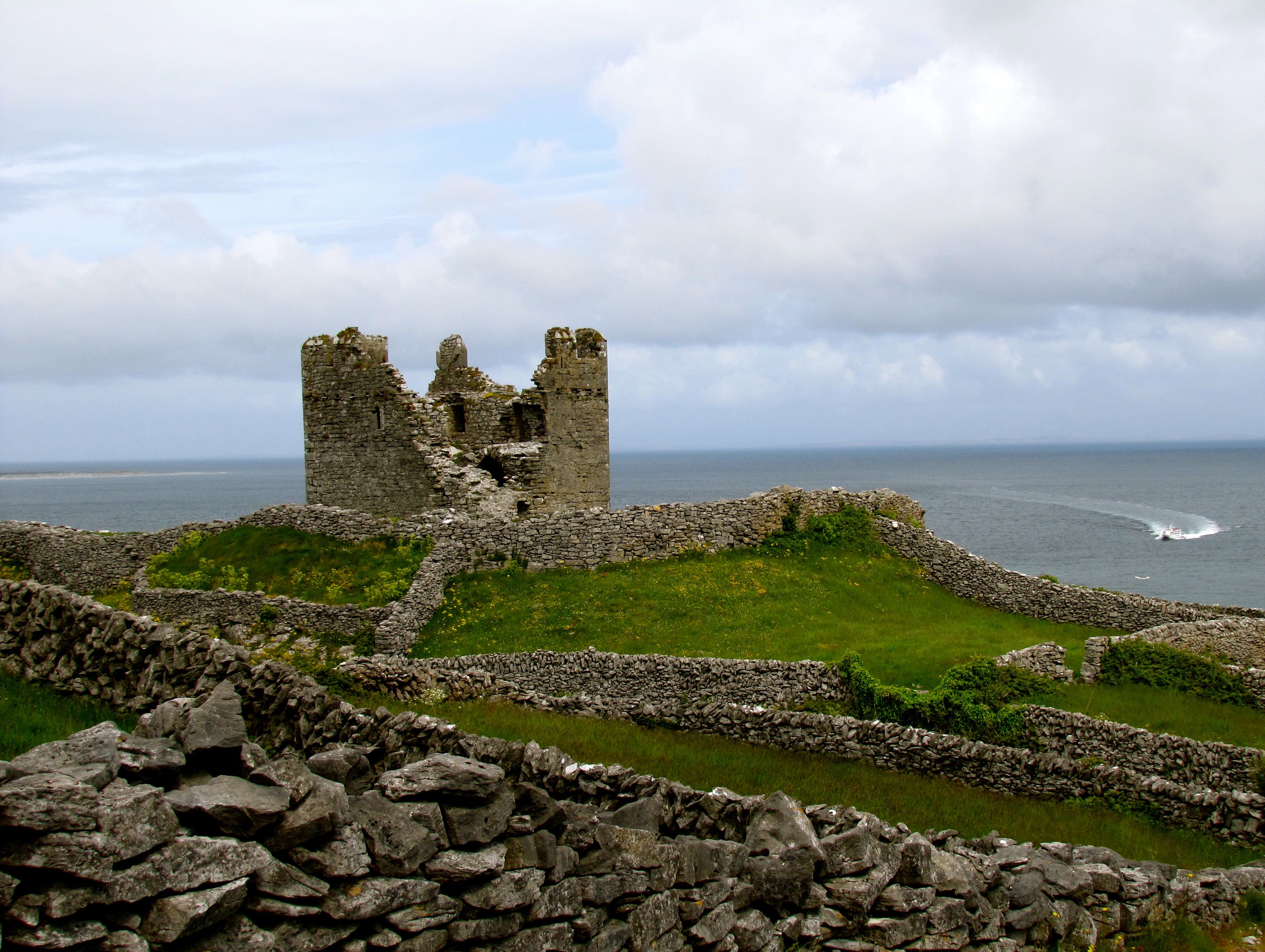
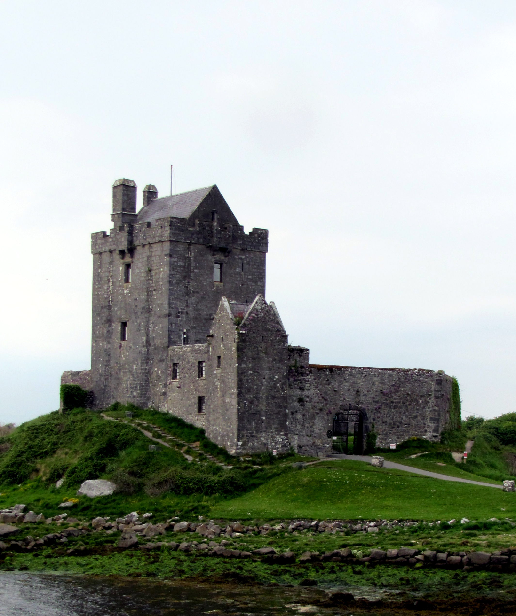
Last photo stop was at Dunguaire Castle. Apparently, I’ve been pronouncing it wrong since I read about it. I was calling it “Dun-gwayr,” but apparently it’s “Doon-gory.”

Still very picturesque. They were getting ready for one of the medieval feasts they hold there, so we couldn’t really go in to look at the inside.

And then it was back to Galway.

Tomorrow, I’ve got a ticket for the hop-on, hop-off bus tour of the city of Galway. That’ll make it easy to get around to places like the cathedral. Depending on how things go, I also want to get some more pictures of Shop Street, the main street through the medieval section of the city, and get to the museum across the street.

But now, doing a little laundry, and relaxing.

  1. One that doesn’t seem to exist, anymore. []

Inisheer and Sheer Cliffs

Today was my trip out to Inisheer and the Cliffs of Moher by ferry. In checking things out last night, I discovered that the piers where the ferries dock is about two miles from where I’m staying at McGann’s Pub. The ferry was set to sail at 10:00, and everyone was supposed to check in by 9:30, so I left McGann’s at 8:30 to walk. I made it in plenty of time, which is good.

This is Doonagore Castle, in the hills over Doolin. Got a decent view of it as I walked down to the pier.
There are two or three different ferry companies running boats to the Aran Islands, and - of course - they all have their offices down at the pier.
There are two or three different ferry companies running boats to the Aran Islands, and – of course – they all have their offices down at the pier.
The sea was doing its level best to put on a good show for us. Some very impressive waves along the coastline.
And just to make sure you didn't forget that it's summer, there are wildflowers growing up everywhere amid the limestone of the Burren.
And just to make sure you didn’t forget that it’s summer, there are wildflowers growing up everywhere amid the limestone of the Burren.
Yes, the name of the ferry is Happy Hooker. It's important to point out that a Galway Hooker is a type of traditional fishing boat.
Yes, the name of the ferry is Happy Hooker. It’s important to point out that a Galway Hooker is a type of traditional fishing boat.

The ride out to Inisheer was a little bit jouncy, but overall, quite nice. The temperature was decent, but there was a fierce wind coming in that cooled everything off. I was glad I had brought my windbreaker.

We sailed past an island with a ruined watchtower on it. It's just off the coast, and provides some shelter for the piers.
We sailed past an island with a ruined watchtower on it. It’s just off the coast, and provides some shelter for the piers.
O'Brien's Castle sits atop the highest hill on the island, inside an old hill fort called Dun Fhormna. You can see it from pretty much anywhere on the island.
O’Brien’s Castle sits atop the highest hill on the island, inside an old hill fort called Dun Fhormna. You can see it from pretty much anywhere on the island.
Pretty much the first thing you see as you get off the ferry is the line-up of locals offering to take you on a tour. A couple of them have minivans, but the majority have a horse and cart. Guess which one I chose.
We got a good view of the castle, with the later addition of a Norman-style tower behind it as we circled the island.
This is what a lot of the streets in the village look like. The roads around the island are very similar, except maybe two feet wider, and gravel.
Another shot of the castle as we circled it.
Cnoc Raithni is a bronze-age tomb that shows the island was inhabited as long ago as 2000 BC.
A different angle on the castle.
In the 1960s, the cargo ship Plassey got on the wrong side of a warning buoy and was holed and wrecked. The inhabitants of the island managed to save the entire crew. It was stuck on the rocks you see in the right of the picture, but high seas in winter time washed it farther up onto the shore.
A neat looking stone house surrounded by stone walls.
Much of the island is a maze of these stone fences, with narrow roads running between them.
Here's a view of the castle from about the site of the signal tower. Have you noticed that I don't have any pictures form inside the castle? That's because the horse wouldn't climb that high. When I went walking later, I couldn't find a trail in - the maze of narrow, rock-lined roads and trails kept leading me away. I KNOW you can get in; I saw people in side. But after three quarters of an hour, I declared myself defeated and went to have some lunch.
Here’s a view of the castle from about the site of the signal tower. Have you noticed that I don’t have any pictures form inside the castle? That’s because the horse wouldn’t climb that high. When I went walking later, I couldn’t find a trail in – the maze of narrow, rock-lined roads and trails kept leading me away. I KNOW you can get in; I saw people in side. But after three quarters of an hour, I declared myself defeated and went to have some lunch.

After lunch, it was time to get back on the ferry for the second part of the cruise. This took us to the base of the Cliffs of Moher. I visited the top last time, and thought this would be a good way to see them again.

Okay. So, we were in a smaller boat. Instead of cutting right into the waves bow-first, we were cutting across the waves, taking them on our side as we approached the Cliffs. I got pretty thoroughly splashed several times, including some times when I had my camera out. I also got dumped on my butt a couple of times. Really glad I had taken some motion-sickness tablets.

The upshot is that the pictures of the Cliffs are not as stunning as I might have hoped. Still, here you go.

Here we are coming up to the Cliffs of Moher from Inisheer.
The cliffs really loom as you get close to them. Also, tons of birds. Mainly seagulls and what someone told me were puffins, but they didn't look like puffins to me. Then again, what do I know about birds?
The cliffs really loom as you get close to them. Also, tons of birds. Mainly seagulls and what someone told me were puffins, but they didn’t look like puffins to me. Then again, what do I know about birds?
If you look very carefully and squint a little, you can see the tip of O'Brian's tower at the top of this cliff. That's where I took some good pictures of the cliffs last time.
If you look very carefully and squint a little, you can see the tip of O’Brian’s tower at the top of this cliff. That’s where I took some good pictures of the cliffs last time.
This spire of rock at the base of the cliffs is just awe-inspiring.

And then the ferry went back to the pier. I got off and walked back to McGann’s. I wasn’t in a rush, this time, so I checked out a few shops along the way, and generally had a nice little stroll.

This is McGann's. I'm staying in a little room on the second floor. You can't see my window - which is in my bathroom - from here. There's a magnificent skylight over my bed, though.
This is McGann’s. I’m staying in a little room on the second floor. You can’t see my window – which is in my bathroom – from here. There’s a magnificent skylight over my bed, though.

Now, laundry is hanging to dry, this post is done, and I’m going to go downstairs in a few minutes to have some supper and wait for the music to start. I may post something later, if something interesting happens, or I may just stay late listening to the session. I don’t have to be up as early tomorrow – my tour of the Doolin Cave doesn’t start until 11:00.

Guess I’ll have to figure out how to get there.

The Burren and the Cliffs of Moher

My last night in Galway. Also, the end of my second week of vacation.

Today I was on a tour through the Burren and to the Cliffs of Moher, with the Galway Tour Company. I cannot say enough good things about the tour company. Yesterday, Mike took me into Connemara, and today Gary took me into the Burren. Both drivers acted as guides, and were fun, funny, knowledgable, and friendly. Both days, we stopped at little, out-of-the-way spots that seemed almost like local secrets, as well as hitting the big tourist areas. These drivers went above and beyond to make sure we all had a good time, and they seem to be indicative of the type of people working for Galway Tour Company.

In short, if you want a tour in this area, these are the people you need to talk to. They’re awesome. So, thanks, Gary and Mike!

The Burren is a rocky, mountainous expanse. Now, I said the same thing about Connemara and the Ring of Kerry, but burren means rocky place in Irish, and it’s something of an understatement.

This is the kind of terrain you get in the Burren. Worn, eroded limestone with small patches of soil and greenery threaded through it.
The road twists through the area. This bit is between a small cliff on one side, and fields leading down to larger cliffs above Galway Bay.
The rock pushes through the soil all over the place here. It makes the coastline a little treacherous, but very scenic.
And, of course, the dry stone fences are everywhere – even here.
One of our stops heading into the Burren was Castle Dunguaire. There are castles and tower houses all over the area – they are so frequent that most tours only stop at one, otherwise you’d never get anywhere.
There are also a lot of swans around. These were in the water by Dunguaire Castle.
We also stopped at an earthen ring fort. The walls were about four feet high, and used to be about two feet higher. The interior was maybe a hundred feet across.
In the middle of the ring fort is a whitethorn tree – another Fairy Tree, complete with the offering cloths tied to the branches.
Ring forts were always built on hills, giving a commanding view of the surrounding area. The trees have grown up over the years, but you can still see a goodly distance over the walls.
This is the Poulnabrone Dolmen, a prehistoric burial site. It’s also one of the most photographed sites in the Burren, so I figured I’d add my efforts to the mix. Also, it’s very cool.
Here’s another view of the dolmen. Up until just a few years ago, visitors were allowed to walk right up to the dolmen, but an act of vandalism resulted in the site being roped off, and a guard posted 24/7. Still, you can get pretty close.
There’s an old, half-collapsed cathedral in Kilfenora. They’ve restored part of it, and put a glass roof over another part, where they’ve placed some old celtic crosses and markers.
We stopped for lunch in the little village of Doolin, a centre for traditional music in Ireland.
And the centre for traditional music in Doolin is Gus O’Connor’s Pub, where we had lunch. There was no live session at the time, but there were some very good recordings playing.
Cliffs of Moher was next. The visitor centre is dug right into the hillside, which I thought was kind of cool.
The trail leads about 8 km from O’Brien’s Tower to Hag’s Head. We started closer to O’Brien’s Tower, so that’s the way I went.
Here’s a shot looking south towards Hag’s Head. It’s hard to appreciate the scale of the cliffs in the pictures – keep in mind that these were used as the model for the Cliffs of Insanity in The Princess Bride.
Here’s a shot looking north from O’Brien’s Tower.
This is a shot of the length of the cliffs from the top of O’Brien’s Tower
Here’s a shot of O’Brien’s Tower, since I’ve been talking about. It was completely restored in the 1970s.
And, just because some of my friends have asked for this, and Garry was amenable, here’s a picture of me standing on the edge of Galway Bay. See? I really AM in Ireland.

So, that was today. Tomorrow, I get on the bus for about six hours, heading to Derry/Londonderry. I’ve got about one week left in Ireland, and I mean to make the most of it.